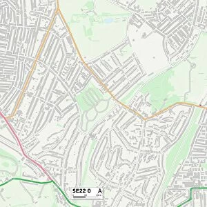
Home > Europe > United Kingdom > England > London > Boroughs > Bromley
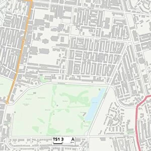
Dacorum HP23 4 Map

![]()
Wall Art and Photo Gifts from Map Marketing
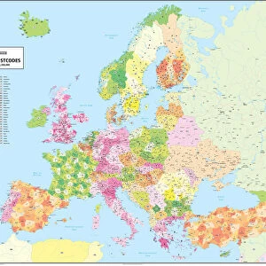
Dacorum HP23 4 Map
Postcode Sector Map of Dacorum HP23 4
Media ID 19972288
Alnwick Drive Ash Road Aylesbury Road Beaconsfield Road Bromley Buckingham Road Chapel Fields Chapel Lane Christchurch Road Church Farm Lane Church Lane Church Road Church View Dacorum Donkey Lane Friars Walk Glovers Lane Grange Road Highfield Road Icknield Way Longfield Road Lower End Mill View Road New Road Parsonage Close Potash Lane Sandon Close Ship Lane St Francis Close Station Road The Crescent The Greenway The Holloway The Orchards Tring Road Vicarage Gardens Vicarage Road Watery Lane Weavers Road Windmill Way Long Marston Ludgate The Mill
FEATURES IN THESE COLLECTIONS
> Animals
> Birds
> Passerines
> Crows And Jays
> Little Raven
> Animals
> Birds
> Passerines
> Fantails
> Related Images
> Animals
> Farm
> Donkeys
> Related Images
> Animals
> Mammals
> Muridae
> Little Wood Mouse
> Arts
> Artists
> P
> Francis Place
> Europe
> United Kingdom
> England
> London
> Boroughs
> Bromley
> Europe
> United Kingdom
> England
> London
> Boroughs
> Harrow
> Map Marketing
> Postcode Sector Maps
> HP - Hemel Hempstead
> Map Marketing
> UK Maps
> Maps and Charts
> Related Images
MADE IN THE USA
Safe Shipping with 30 Day Money Back Guarantee
FREE PERSONALISATION*
We are proud to offer a range of customisation features including Personalised Captions, Color Filters and Picture Zoom Tools
SECURE PAYMENTS
We happily accept a wide range of payment options so you can pay for the things you need in the way that is most convenient for you
* Options may vary by product and licensing agreement. Zoomed Pictures can be adjusted in the Cart.