Home > Europe > United Kingdom > England > London > Boroughs > Hounslow
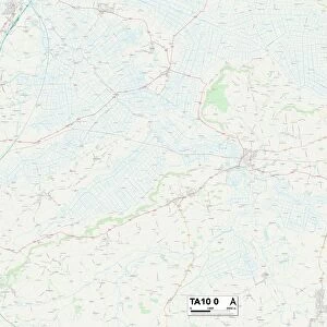
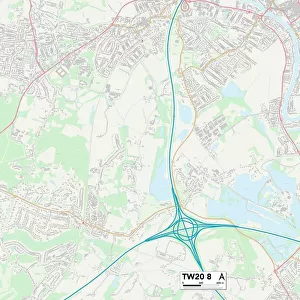
Hounslow TW4 6 Map

![]()
Wall Art and Photo Gifts from Map Marketing
Hounslow TW4 6 Map
Postcode Sector Map of Hounslow TW4 6
Media ID 19980072
Amberley Way Arundel Road Barrack Road Byron Avenue Causeway Chaucer Avenue Chester Road Dukes Avenue Ely Road Fairway Close Field Close Green Lane Hounslow Laurel Gardens Lawrence Road Lichfield Road Regent Close Salisbury Road The Parkway Warwick Road Woodfield Road
FEATURES IN THESE COLLECTIONS
> Animals
> Insects
> Spiders
> Silver Garden
> Europe
> Italy
> Lazio
> Tivoli
> Europe
> United Kingdom
> England
> London
> Boroughs
> Hounslow
> Map Marketing
> Postcode Sector Maps
> TW - Twickenham
> Map Marketing
> UK Maps
> Maps and Charts
> Related Images
MADE IN THE USA
Safe Shipping with 30 Day Money Back Guarantee
FREE PERSONALISATION*
We are proud to offer a range of customisation features including Personalised Captions, Color Filters and Picture Zoom Tools
SECURE PAYMENTS
We happily accept a wide range of payment options so you can pay for the things you need in the way that is most convenient for you
* Options may vary by product and licensing agreement. Zoomed Pictures can be adjusted in the Cart.