Home > Architecture > Country > Belgium
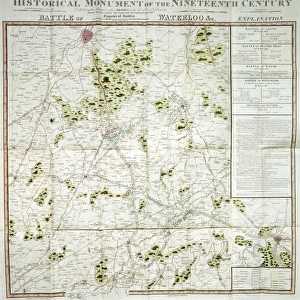
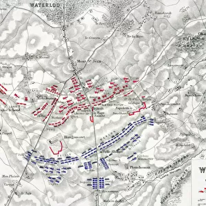
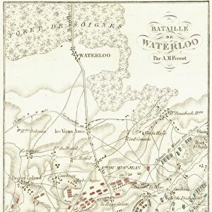
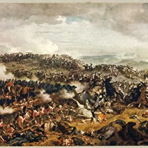
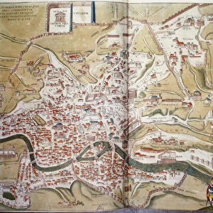
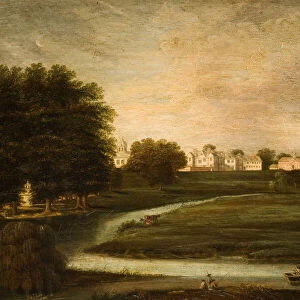
Map of the Battle of Waterloo, 18 June 1815

![]()
Wall Art and Photo Gifts from Universal Images Group (UIG)
Map of the Battle of Waterloo, 18 June 1815
Cartography, 19th century. Map of the Battle of Waterloo (18 June 1815) won by the armies under the command of the Duke of Wellington (1769-1852) and Prince von Wahlstaff (1742-1819), against Napoleon I army
Universal Images Group (UIG) manages distribution for many leading specialist agencies worldwide
Media ID 9571193
© DEA / G. DAGLI ORTI
1815 Battle Belgium Border Boundary Conflict Confrontation Elevated View Field Fighting Franz Hogenberg Georg Braun Guidance Human Settlement Navigational Equipment Rivalry Siena Strategy Text Tuscany Battle Of Waterloo Non Urban Scene
FEATURES IN THESE COLLECTIONS
> Architecture
> Country
> Belgium
> Arts
> Art Movements
> Landscapes
> Arts
> Artists
> H
> Franz Hogenberg
> Arts
> Contemporary art
> Landscapes
> Nature landscapes
> Arts
> Contemporary art
> Landscapes
> Urban landscapes
> Arts
> Landscape paintings
> Landscape art
> Nature-inspired artwork
> Arts
> Landscape paintings
> Landscape art
> Arts
> Landscape paintings
> Nature-inspired artwork
> Arts
> Still life artwork
> Landscape paintings
> Architectural paintings
> Arts
> Still life artwork
> Landscape paintings
> Nature-inspired artwork
> Universal Images Group (UIG)
> Art
> Painting, Sculpture & Prints
> Cartography
EDITORS COMMENTS
This print showcases a remarkable piece of cartography from the 19th century - the Map of the Battle of Waterloo, which took place on 18 June 1815. The battle was an epic confrontation between the armies led by two influential figures: the Duke of Wellington and Prince von Wahlstaff, against Napoleon I's army. This meticulously crafted map provides a comprehensive view of the battlefield, capturing both its natural features and strategic elements. The image transports us back in time to witness this historic clash unfold amidst a picturesque landscape in Belgium. The topography is intricately depicted, allowing us to visualize how nature played a role in shaping the course of this intense conflict. With its vertical orientation and detailed text annotations, this map serves as an invaluable navigational tool for understanding key locations and boundaries during one of history's most significant battles. As we delve into this artwork further, we appreciate not only its historical significance but also its artistic value. Created with precision and skill by Georg Braun and Franz Hogenberg, it exemplifies their mastery over cartographic illustration and painting techniques. Through this print from Universal Images Group (UIG), we are reminded once again that art can be found even in maps - they tell stories about our past while simultaneously guiding us through space and time.
MADE IN THE USA
Safe Shipping with 30 Day Money Back Guarantee
FREE PERSONALISATION*
We are proud to offer a range of customisation features including Personalised Captions, Color Filters and Picture Zoom Tools
SECURE PAYMENTS
We happily accept a wide range of payment options so you can pay for the things you need in the way that is most convenient for you
* Options may vary by product and licensing agreement. Zoomed Pictures can be adjusted in the Cart.