Home > Europe > United Kingdom > England > London > Boroughs > Bromley
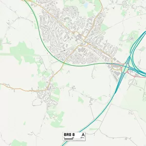
Bromley BR4 9 Map

![]()
Wall Art and Photo Gifts from Map Marketing
Bromley BR4 9 Map
Postcode Sector Map of Bromley BR4 9
Media ID 19965904
Acacia Gardens Addington Road Ashby Close Bramley Way Bromley Chatsworth Close Cherry Tree Walk Chestnut Avenue Church Drive Cunningham Close Dukes Way Farm Close Glebe Way Hartfield Road Hawthorn Drive High Mead Highbury Close Highfield Drive Keswick Road Kingsway Lawrence Road Lime Tree Walk Manor Road Martins Close Monarch Close Oak Avenue Oaklands Avenue Palmer Close Phoenix Close Princes Way Queensway Rosslyn Close Rydal Drive Sherwood Way South Walk Springfield Gardens Sylvan Way The Alders The Glade The Grove Tudor Gardens Windermere Road Woodland Way West Wickham
FEATURES IN THESE COLLECTIONS
> Animals
> Mammals
> Muridae
> Little Wood Mouse
> Europe
> United Kingdom
> England
> London
> Boroughs
> Bromley
> Europe
> United Kingdom
> Wales
> Mid Glamorgan
> Aberdare
> Map Marketing
> Postcode Sector Maps
> BR - Bromley
> Map Marketing
> UK Maps
> Maps and Charts
> Related Images
MADE IN THE USA
Safe Shipping with 30 Day Money Back Guarantee
FREE PERSONALISATION*
We are proud to offer a range of customisation features including Personalised Captions, Color Filters and Picture Zoom Tools
SECURE PAYMENTS
We happily accept a wide range of payment options so you can pay for the things you need in the way that is most convenient for you
* Options may vary by product and licensing agreement. Zoomed Pictures can be adjusted in the Cart.