Home > Arts > Street art graffiti > Digital art > Vector illustrations
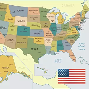
Pasadena California US City Street Map

![]()
Wall Art and Photo Gifts from Fine Art Storehouse
Pasadena California US City Street Map
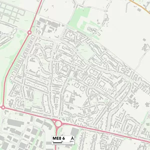
Vector Illustration of a City Street Map of Pasadena, California, USA. Scale 1:60, 000.
All source data is in the public domain.
U.S. Geological Survey, US Topo
Used Layers:
USGS The National Map: National Hydrography Dataset (NHD)
USGS The National Map: National Transportation Dataset (NTD)
Unleash your creativity and transform your space into a visual masterpiece!
Frank Ramspott
Media ID 15055095
© Frank Ramspott, all rights reserved
Aerial View California City Map Computer Graphic Directly Above Downtown District Gray Road Map Text Digitally Generated Image Green Color Pasadena White Color
FEATURES IN THESE COLLECTIONS
> Aerial Photography
> Related Images
> Animals
> Insects
> Hemiptera
> Green Scale
> Animals
> Mammals
> Cricetidae
> California Mouse
> Arts
> Contemporary art
> Digital artwork
> Street art
> Arts
> Landscape paintings
> Waterfall and river artworks
> River artworks
> Arts
> Portraits
> Pop art gallery
> Street art portraits
> Arts
> Street art graffiti
> Digital art
> Digital paintings
> Arts
> Street art graffiti
> Digital art
> Vector illustrations
> Fine Art Storehouse
> Map
> Street Maps
> Fine Art Storehouse
> Map
> USA Maps
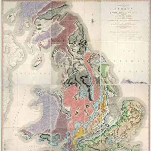
> Maps and Charts
> Geological Map
> Maps and Charts
> Related Images
EDITORS COMMENTS
This print showcases a meticulously detailed city street map of Pasadena, California, USA. With a scale of 1:60,000, every intricate aspect of the city's layout is beautifully illustrated in this vector image. The source data used to create this masterpiece is all from the public domain and includes valuable information from the U. S. Geological Survey's National Hydrography Dataset (NHD) and National Transportation Dataset (NTD). The artwork captures Pasadena's vibrant downtown district with its bustling streets, meandering river, and serene lake. Every road and intersection is accurately depicted on this visually stunning map that seamlessly combines cartography with modern design techniques. Digitally generated without any people present, the image focuses solely on the physical geography of Pasadena. From an aerial view directly above the city, shades of gray highlight roads while green signifies lush areas and blue represents water bodies. The text elements are elegantly incorporated in white color for easy readability. This remarkable piece by Frank Ramspott offers a unique perspective on Pasadena's urban landscape that will surely captivate both locals and visitors alike. Whether you're exploring or simply appreciating artistry at its finest, this print serves as an exquisite tribute to one of California's most iconic cities.
MADE IN THE USA
Safe Shipping with 30 Day Money Back Guarantee
FREE PERSONALISATION*
We are proud to offer a range of customisation features including Personalised Captions, Color Filters and Picture Zoom Tools
SECURE PAYMENTS
We happily accept a wide range of payment options so you can pay for the things you need in the way that is most convenient for you
* Options may vary by product and licensing agreement. Zoomed Pictures can be adjusted in the Cart.